The project
200 acres on the Lagos–Calabar Coastal Highway
Lagos–Calabar Coastal Highway, Ibeju-Lekki, Lagos State, Nigeria. Direct frontage onto the new carriageway, between the Dangote refinery and the eastern reach of Ibeju-Lekki. Planned as one contiguous parcel so that roads, drainage and services can be laid out properly instead of stitched around existing plots.
Location
Where it sits on the corridor
The corridor today
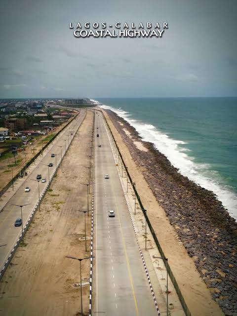
The completed carriageway on the Atlantic edge, rock armour holding the shoreline.
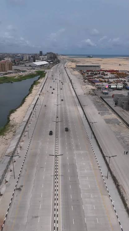
A finished section in use, lagoon on one side and working yards on the other.
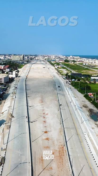
Concrete laid through the built-up Lagos stretch, the ocean beyond.
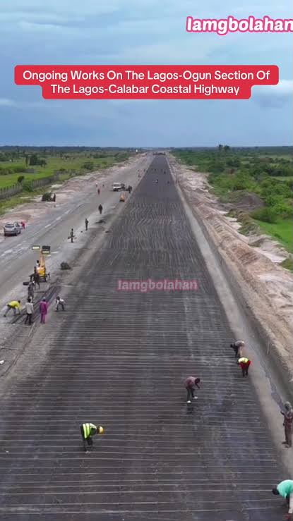
Works in progress: crews laying sub-base on an open section.
Lekki Deep Sea Port
West Africa's deepest port. Puts container and project cargo within a short haul of the site.
Dangote Refinery & Petrochemicals
The largest single-train refinery in the world, and the corridor's biggest employer of skilled labour.
Lekki Free Zone
Established industrial and manufacturing base already drawing tenants and workforce to Ibeju-Lekki.
Subsea cable landings
Equiano, 2Africa, MainOne and Glo-1 come ashore on this coast. That proximity is what makes an edge data centre viable here and nowhere inland.
Lagos–Calabar Coastal Highway
The federal coastal carriageway under construction along the Atlantic seaboard, giving the site direct frontage and onward access east.
Straight answers
The questions people actually ask
Why this corridor and not Lagos proper?
Because the land inside Lagos that is worth building on is already priced as if the infrastructure exists. Ibeju-Lekki is where the port, the refinery and the free zone are pulling employment, and where a developer can still assemble a contiguous parcel large enough to plan properly rather than infill a leftover block.
Why does the coast matter beyond the view?
Four subsea cables come ashore near here. Fibre capacity at the landing station is the reason an edge data centre can be economic on this site and not fifty kilometres inland. That single fact is what turns a housing scheme into an infrastructure business.
What happens if the highway is delayed?
The site is planned to work off existing Lekki-Epe access as well as the new carriageway. The Coastal Highway improves the position; it is not the only route in. Phasing is arranged so that the first phase does not depend on a completion date the developer does not control.
Is the land secured?
Acquisition, survey, titling and the environmental impact assessment sit inside Phase 1 of the programme and are funded from the Phase 1 raise. The boundary shown on the corridor diagram is indicative until title and survey are complete — we would rather say that plainly than imply otherwise.
Programme
What gets built, and when
The full build runs 84 months. Phases are sequenced so each one is habitable and revenue-generating before the next begins.
- Phase 1Months 0–24
Land, horizontal infrastructure and the first neighbourhood
- Site acquisition, survey, titling and environmental impact assessment
- Primary roads, drainage, water treatment and the solar-plus-storage plant
- Edge data centre shell and first megawatt of IT load
- First residential release and the civic core groundworks
- Phase 2Months 24–48
Commercial anchor and social infrastructure
- Business and technology district first buildings, leased not sold
- District hospital and the primary and secondary schools open
- Retail spine and covered market trading
- Second and third residential releases
- Phase 3Months 48–66
Density, park and innovation park
- Central park, wetland works and sports precinct complete
- Innovation park buildings alongside the expanded data centre
- Technical college opens
- Mid-rise residential density added on serviced land
- Phase 4Months 66–84
Completion and stabilised operations
- Final residential releases and full occupancy push
- Utilities, connectivity and services running as a stabilised operating business
- Second-city site selection using the same playbook